I think this is where we are going to be in early November for our winter shakedown. I’m thinking of looping somewhere behind Davidson Campground on the Art Loeb trail.
Anyone have any experience out here?
Showing posts with label north carolina. Show all posts
Showing posts with label north carolina. Show all posts
Monday, September 9, 2013

Thursday, August 8, 2013
Shakedown Hike #1 / North Carolina Adventuretime: (out)Standing Indian Mountain hiking!
Saturday, July 20
We woke up around 8:30am and enjoyed a simple breakfast. I had a banana and a cup of Tang, while Chase went for the honey bun and a cup of coffee. We left the hotel soon after and arrived at the trailhead a little after 11:30am. I was super stoked to finally get on the trail and was ready to go soon after arriving. Chase took a little more time to make sure he had everything and that the car would be secure, but we were soon making our way happily down the trail.
We did it! I kept thinking to myself, We made it and we are actually hiking! I am setting out on my very first backpacking trip! It was surreal! And awesome!
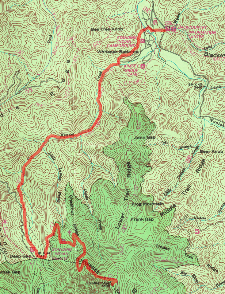
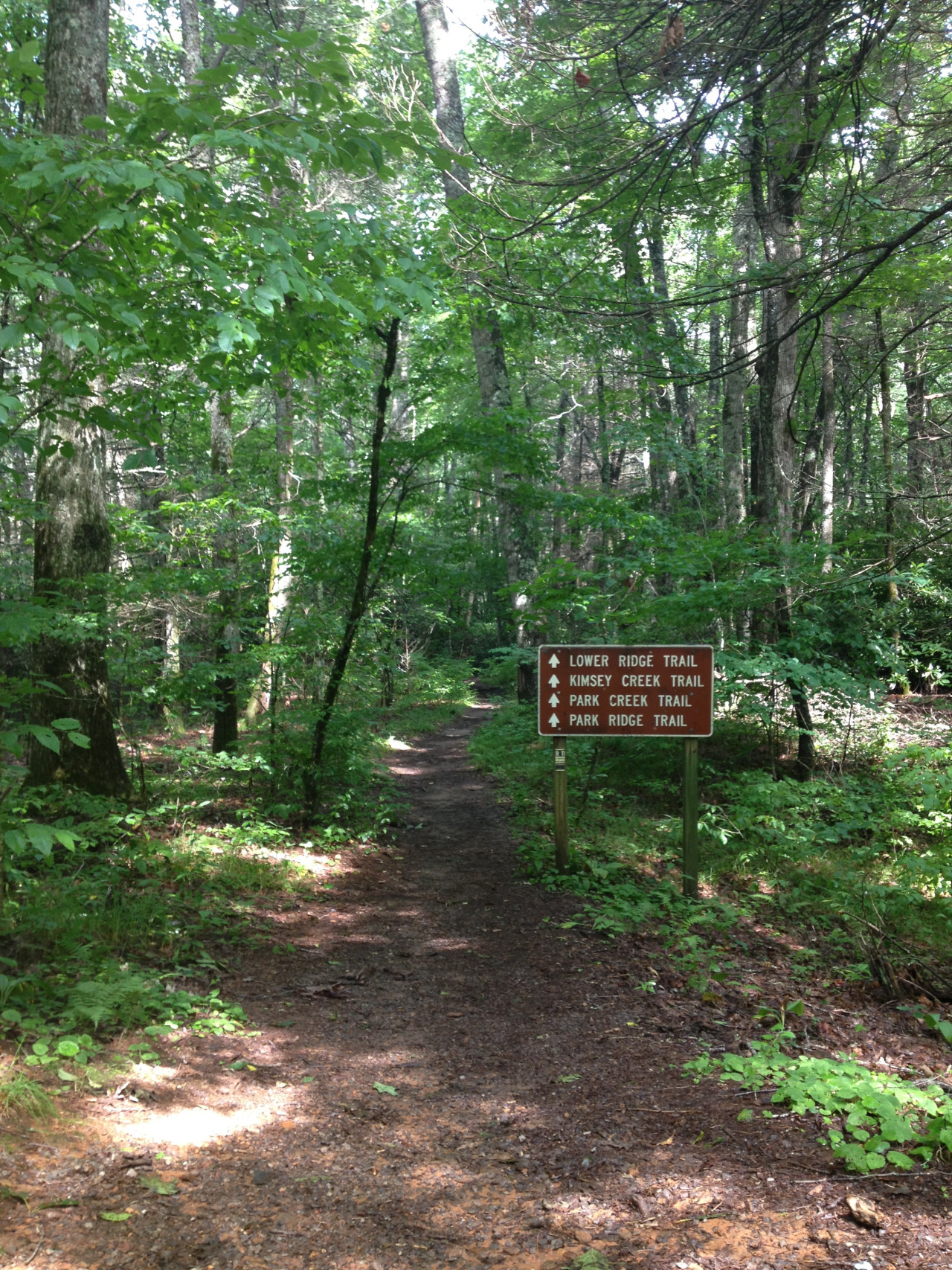
The Kimsey Creek Trail starts at the Standing Indian Campground Backcountry Information center and then cuts through some of the campground before shooting off to follow the Kimsey Creek up to Deep Gap. This trail was listed in the “More Difficult” section of the backcountry trails surrounding Standing Indian, and they really meant it. The trail began going uphill very steeply within the first half-mile, and I thought I was going to hate backpacking. I am not in very good cardiovascular shape, and I was breathing heavy in under 2 minutes of the climb. But it got easier elevation-wise and we were soon paralleling the creek.
This was both refreshing and bothersome! Such a beautiful mountain stream! So many gnats! I was stopping every few steps to pick them out of my eyelashes. Yeah. Totally gross. (We used a picaridin-based bug spray, and it worked awesome! But it doesn’t repel gnats.)
Eventually we made it the 4.2 miles to Deep Gap! How wonderful it was until I realized that it was another mile to Standing Indian Shelter, and that hiking a mile takes more than a minute. The hike from the parking area to the shelter was pretty and less buggy for sure. We could hear thunder in the distance and the skies threatened rain, but we were spared. Making it to the shelter was wonderful. There were two hikers there who were setting up to spend the night. They had come from Carter Gap that day and enjoyed several weekend hikes throughout the year. They were very nice and even let us have a spare lighter when we realized we had forgotten to stop at the convenience store to pick one up.
We ate a lunch of a bagel with summer sausage and cheese spread at the shelter. Chase and his dad enjoyed the old “bagel and log” during scouting, but I don’t think it will be something I take as a viable meal on the trail. It was heavy in my pack and heavy in my stomach! One of the hikers at the shelter said he was cooking chicken and dumplings from scratch that night, but I didn’t ask him how he did it. It sounded too good to be true.
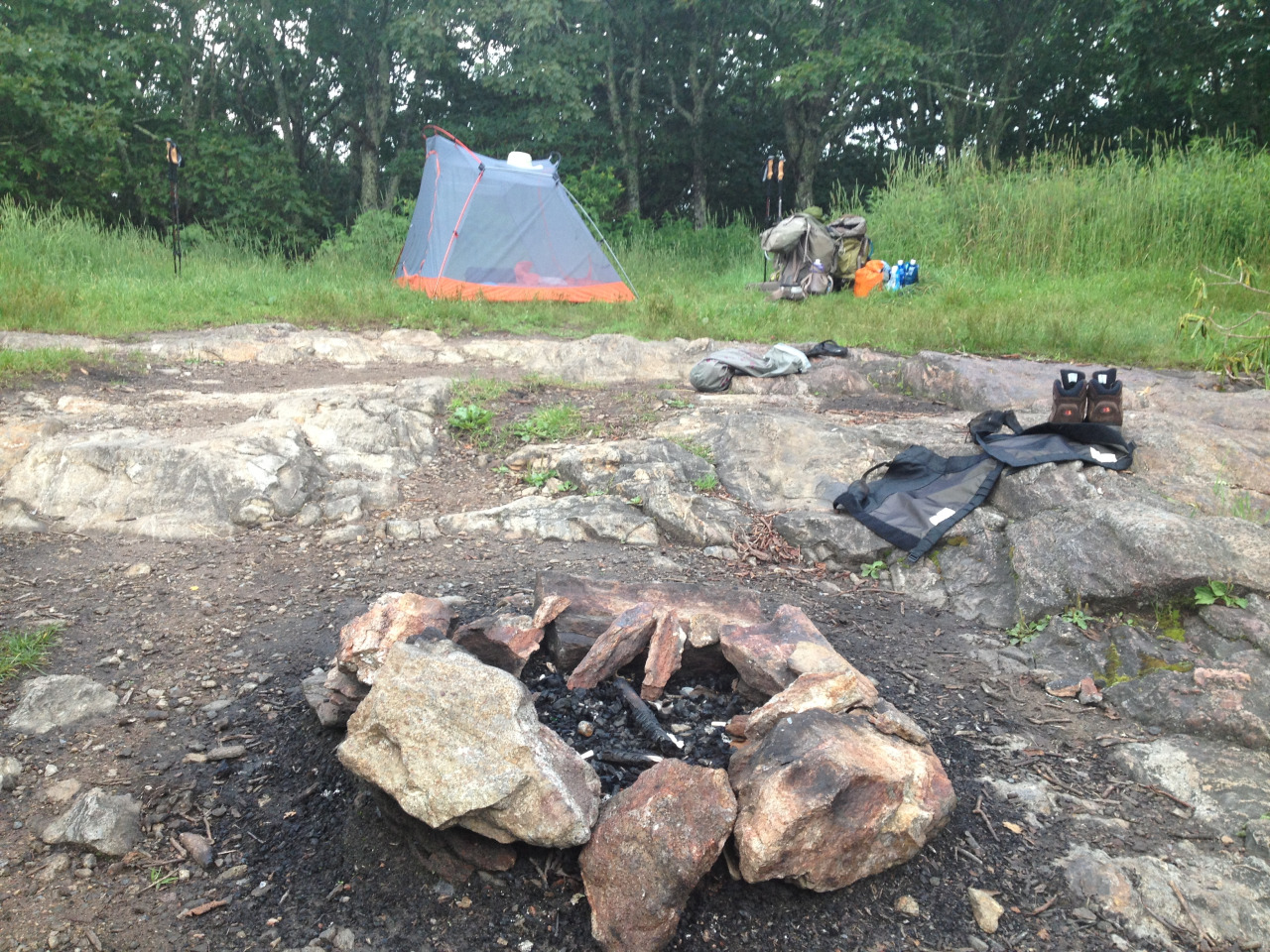
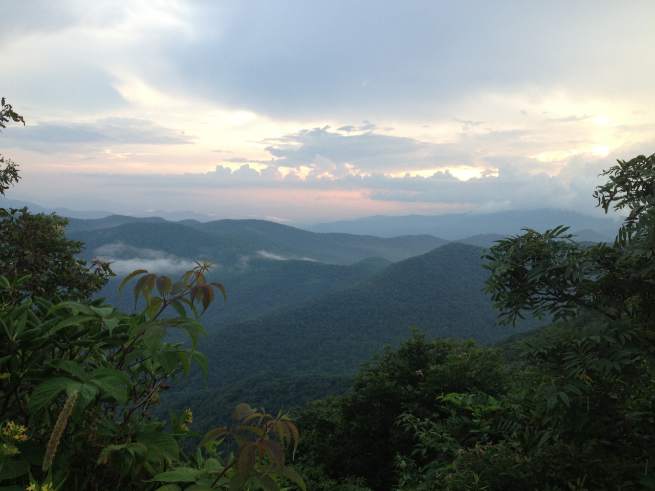
We filtered water to refill our hydration packs and bottles and carried dirty water to bring to the summit of Standing Indian, which is where we planned to camp that night. After leaving the shelter, it was a quick but steep two and a half miles to the summit. Our campsite was perfect. A grassy spot for the tent, exposed rock to cook on, a clearing to hang the food and relieve ourselves in, everything was wonderful. We got there a little bit late, so we ended up cooking a dinner of black beans and rice and tortillas in the dark. We didn’t get to bed until after 9:30pm. I didn’t sleep very well due to my sleeping pad going flat in the middle of the night (an REI garagesale item that I got for $20, so I’m not that upset). It rained in the middle of the night, and it was quite peaceful listening to the rain hit the fly.
Friday, August 2, 2013
Hickory Nut Gap Inn

Mountain Moonrise 1
Bat Cave, North Carolina
Courtesy of pspo.co
Our view from the cabin. This is actually the moon coming up over the top of the ridge. So beautiful.
Tuesday, July 30, 2013
Shakedown Hike #1 / North Carolina Adverturetime: Pre(mis)adventure Preparations
We had a blast on the trail, and there is a lot to be told! I will be breaking up these posts according to our pre-hike preparations, the hike, and an overall gear impressions post! Check back for updates!
Thursday, July 18
Today was a boring, uneventful day at my desk job that was only made brighter by the fact that I was leaving an hour early in order to go home and begin packing for our impending trip up to North Carolina. Chase was supposed to be at home gathering all of our gear and treating our clothing with pemethrin and I had already done a small amount of preparation so I thought that I wouldn’t have much to do when I got home. It turned out that we still had a lot of things to take care of and we were not all together ready for what we were about to do! This was stressful since we had talked about leaving by 7am to make it to Standing Indian Campground after lunch on Friday.
My pack was not fully packed until around midnight, and at that point I realized that no matter how I adjusted and fiddled with my pack, it was not sitting comfortably at all. I felt much of the weight on my hips, but the pack couldn’t get close enough to my back to prevent the shoulder straps from cutting into my collarbones. This was not okay. I tried everything over the next hour to get my pack to sit correctly on my frame. I reorganized the load with no luck. I adjusted all of my straps and the height of the harness itself, fiddling with different combinations of lengths but it was to no avail. Frustrated and defeated and more than a little grumpy, I finally decided to just go to bed an deal with it in the morning.
I did not want to start our adventure grumpy and with an ill-fitting pack so thankfully a decent night’s sleep changed my attitude for the better.
Friday, July 19
We awoke around 9am and slowly got the car packed while discussing our options for the day. We had already planned to stop at the Patagonia in Atlanta to exchange a pair of defective boots Chase had purchased on Steep and Cheap for me, so we decided to also stop at one of the REI’s in the Atlanta area, figuring that they would be more knowledgeable of my situation and needs than our local Jacksonville store. With a delicious smoothie for breakfast, we set off on the 6+ hour drive to Atlanta.
The Patagonia ended up being located in a little sketchy strip-mall area, but we were happy to make it there! Their customer service was phenomenal! The girl who helped us exchange my boots was extraordinarily helpful. She let us exchange the size after I tried the boots on again in the store and decided they were not the proper fit, but they didn’t have the next size up in stock, so she called Patagonia Boston and had them ship the correct size to our apartment at no charge! It was really incredible considering the boots are not even being made anymore and we did not even order them directly from Patagonia. What an awesome company!
Next we ventured to the closest REI and proceeded to spend two and half hours or more trying on multiple brands of packs and different combinations of sizes after it was determined that my Osprey Ariel was just a tad too small. I was between sizes, not quite small and not quite medium, and it was endlessly frustrating. I tried every brand with a pack that fit my specifications multiple times, debating over each one. The only bag that seemed to fit better than the Osprey that I had already was the Gregory Deva 60. It took a little bit of getting used to the intense lumbar support, but the pack fit my frame very nicely when adjusted properly. Chase and I wanted to test out one more combination of a medium harness on the small Osprey bag, but the REI we were in mistakenly only had a large harness for the medium Ariel pack. We decided to go ahead and see if the other REI had the correct medium harness for me to try out. We also decided to buy the Gregory pack in case they didn’t have it at the other REI (which was clear across town and it was rush hour) and if the medium harness did not help my situation. I’m glad we did because the other REI had the medium harness but not the medium bag to go with it, and the combination of medium harness/small bag was not working. So I spent $330 on a new pack and got a store credit for my Osprey since it was a gift. It was hard swallowing the cost of this gear change, but I’m sure we will spend that money on something else… like a Palisades Dog Pack!
It was now after 9pm and Chase had spent the last 30 minutes trying to find a cheap hotel for us to stay in, since we were obviously not going to be hitting the trail that day. We ended up booking at America’s Best Value Inn in Clayton, GA, and had a lovely night sleep. It was easy to sleep well knowing that my pack issues had been solved and that we would be finally setting foot on the trail the very next day!
Sunday, July 28, 2013
Hey y'all!
We just finished up our vacation in North Carolina! Our shakedown hike went well, but I am too tired to post about it now. Maybe tomorrow or the next day. :)
Thursday, July 18, 2013
Wore my hiking boots at work all day
And now I’m rushing home to pack my bag.
The mountains are calling, and I must go.
The mountains are calling, and I must go.
Saturday, July 6, 2013
Shakedown Hike #1
… is approaching quickly! Too quickly almost!
Chase and I will be hiking the popular Nantahala Basin Loop trail, which encompasses about 18 miles of the AT from Deep Gap to Glassmine Gap. I found this hike on Everytrail and it seemed to be the perfect hike for what we needed: a multi-day loop with a variety of terrain. We have a few options regarding the actual route of the hike, and I’d like to present those options here:
Option 1:
Long Branch Trail from Standing Indian Campground to meet the AT at Glassmine Gap (2.0 miles). Take the AT south to Albert Mountain, with the option to camp on the summit (3.5 miles), or continue to either Betty Creek Gap (5.7 miles) or Carter Gap (9.4 miles) depending on how we feel. I’m expecting a short day and the 5.5 miles to Albert might be enough to exhaust us completely. The next day, we could hike from the summit of Albert to Carter Gap (6.2 miles) , Betty Creek Gap to Beech Gap (6.9 miles), or from Carter Gap to Standing Indian (6.1 miles). Day 3 would encompass either Carter Gap to Standing Indian (6.1 miles) , Beech Gap to Standing Indian (2.9 miles), or taking the Lower Ridge Trail from the summit of Standing Indian back to the campground (4.2 miles). The 4.2 miles from the summit of Standing Indian would make for a short half-day hike on the last day. This would be 22 miles total over possibly 3-4 days!
Option 2:
Kimsey Creek Trail from Standing Indian Campground to Deep Gap (3.7 miles). Take the AT north to Standing Indian Mountain (2.4 miles) with the option to camp on Standing Indian. We could also push on to Carter Gap another 6.1 miles from the summit of Standing Indian, but I doubt we will. From there, Day 2 would be Standing Indian to Carter Gap (6.1 miles), or Carter Gap to Albert Mountain (6.2 miles). Albert Mountain to Glassmine Gap is only 3.2 miles, and the exit trail along Long Branch is only 2.0 miles, making for a short Day 3/4. This trail route is 23.6 miles!
Option 3:
Lower Ridge Trail straight up to Standing Indian Mountain (4.2 miles), where we could camp or press on another 2.9 miles to Beech Gap. On Day 2, from Standing Indian to Carter Gap is 6.1 miles, and our hike would be much of the same as Option 2 for the final miles. If we make it to Beech Gap, Betty Creek Gap is 6.9 miles away, and our third day would encompass the steep climb up Albert Mountain (2.5 miles) and camping at Long Branch Shelter (4.9 miles total from Betty Creek), and a short day from Long Branch Shelter back to Standing Indian Campground (2.8 miles). This would add up to a total mileage of 21.7 miles!
I’m personally leaning toward Option #2! This option will show us the trail as we will see it when we set off next year, with the opportunity to summit two mountains and camp on each. The mileage is also uniform, which I think I will benefit from as this will be my first backpacking trip.
AWOL’s A.T. Guide (2013 edition) shows the terrain for this section hike on page 16, which will be very convenient for us. I highly recommend this book to anyone hiking the Appalachian Trail, thru- or not.

Overall I’m really stoked to finally get out on the trail and test out my gear. I really wish we could bring the dog, but the logistics didn’t work out this time since we will be spending time after our hike with friends and family.
I will be posting lots of pictures and probably initial gear reviews after the hike!
Chase and I will be hiking the popular Nantahala Basin Loop trail, which encompasses about 18 miles of the AT from Deep Gap to Glassmine Gap. I found this hike on Everytrail and it seemed to be the perfect hike for what we needed: a multi-day loop with a variety of terrain. We have a few options regarding the actual route of the hike, and I’d like to present those options here:
Option 1:
Long Branch Trail from Standing Indian Campground to meet the AT at Glassmine Gap (2.0 miles). Take the AT south to Albert Mountain, with the option to camp on the summit (3.5 miles), or continue to either Betty Creek Gap (5.7 miles) or Carter Gap (9.4 miles) depending on how we feel. I’m expecting a short day and the 5.5 miles to Albert might be enough to exhaust us completely. The next day, we could hike from the summit of Albert to Carter Gap (6.2 miles) , Betty Creek Gap to Beech Gap (6.9 miles), or from Carter Gap to Standing Indian (6.1 miles). Day 3 would encompass either Carter Gap to Standing Indian (6.1 miles) , Beech Gap to Standing Indian (2.9 miles), or taking the Lower Ridge Trail from the summit of Standing Indian back to the campground (4.2 miles). The 4.2 miles from the summit of Standing Indian would make for a short half-day hike on the last day. This would be 22 miles total over possibly 3-4 days!
Option 2:
Kimsey Creek Trail from Standing Indian Campground to Deep Gap (3.7 miles). Take the AT north to Standing Indian Mountain (2.4 miles) with the option to camp on Standing Indian. We could also push on to Carter Gap another 6.1 miles from the summit of Standing Indian, but I doubt we will. From there, Day 2 would be Standing Indian to Carter Gap (6.1 miles), or Carter Gap to Albert Mountain (6.2 miles). Albert Mountain to Glassmine Gap is only 3.2 miles, and the exit trail along Long Branch is only 2.0 miles, making for a short Day 3/4. This trail route is 23.6 miles!
Option 3:
Lower Ridge Trail straight up to Standing Indian Mountain (4.2 miles), where we could camp or press on another 2.9 miles to Beech Gap. On Day 2, from Standing Indian to Carter Gap is 6.1 miles, and our hike would be much of the same as Option 2 for the final miles. If we make it to Beech Gap, Betty Creek Gap is 6.9 miles away, and our third day would encompass the steep climb up Albert Mountain (2.5 miles) and camping at Long Branch Shelter (4.9 miles total from Betty Creek), and a short day from Long Branch Shelter back to Standing Indian Campground (2.8 miles). This would add up to a total mileage of 21.7 miles!
I’m personally leaning toward Option #2! This option will show us the trail as we will see it when we set off next year, with the opportunity to summit two mountains and camp on each. The mileage is also uniform, which I think I will benefit from as this will be my first backpacking trip.
AWOL’s A.T. Guide (2013 edition) shows the terrain for this section hike on page 16, which will be very convenient for us. I highly recommend this book to anyone hiking the Appalachian Trail, thru- or not.
Overall I’m really stoked to finally get out on the trail and test out my gear. I really wish we could bring the dog, but the logistics didn’t work out this time since we will be spending time after our hike with friends and family.
I will be posting lots of pictures and probably initial gear reviews after the hike!
Thursday, June 20, 2013
Favorite hikes in NC?
Chase and I are heading up that way in mid-July and would like to use this opportunity to test out gear on a couple of overnight hikes in the western North Carolina area. We would prefer a loop hike or a hike where we can get back to the car without having to just hike out a certain distance and then turn around.
Any suggestions?
Any suggestions?
Subscribe to:
Posts (Atom)